TravelPhotographyAbout

Kyrgyzstan

Kyrgyzstan Field Notes

A practical 14-day route, honest notes and photography from the road.

  • Travel
  • Photography
  • About

Change language

PrivacyTerms

© 2026 Musab. Field notes by Musab.

  1. Overview
  2. Route Map
  3. Itinerary
  4. Practical Info
  5. Budget & Costs
  6. Packing List
  7. Creator Notes
  8. Full Field Notes
Get the free English planner
  1. Travel
  2. Kyrgyzstan
  3. Overview
  4. Creator Notes
Back to Field Notes

Kyrgyzstan Field Notes

Creator Notes

A route-wide photography field guide to light, access, power, permission and the decisions behind the images.

Photography on the road

A field workflow, not a gear list

This route-specific capture plan is based on my photographs and travel record from August 2025. It covers light, access, power, storage and respectful photography—not unverified camera settings.

Created by
Photographed and documented by Musab
First-hand trip
2–15 August 2025
Editorial review
20 July 2026
Observed
What I encountered on the August 2025 route.
Plan
How I would protect the photograph or workflow now.
Reconfirm
Rules, access, weather or permission can change.

Decide before departure

Three choices protect the work

The strongest gains come from time, resilience and permission—not from carrying more equipment.

  1. 1

    Protect the no-relocation days

    Song-Kul, Kel-Suu and Altyn Arashan each had a full day. Those pauses made changing light and weather part of the story instead of a scheduling problem.

    See the capture phases
  2. 2

    Use cities as operational resets

    Leave Bishkek with maps, power and storage ready; use Karakol to back up, charge, clean and simplify before the next leg.

    See the field workflow
  3. 3

    Separate access from permission

    Reaching a location does not grant permission to photograph people, restricted subjects or fly a drone.

    Read the safety boundary

Route capture plan

Five phases across all 14 days

This follows the complete route instead of presenting six isolated photo stops. Each phase separates the trip record from a planning recommendation and a live check.

Day 1Days 2–6Days 7–8Days 9–11Days 12–14
  1. 1

    Day 1

    City context under flight pressure

    Bishkek · Osh · Sulaiman-Too

    Open this phase in the itinerary
    Observed
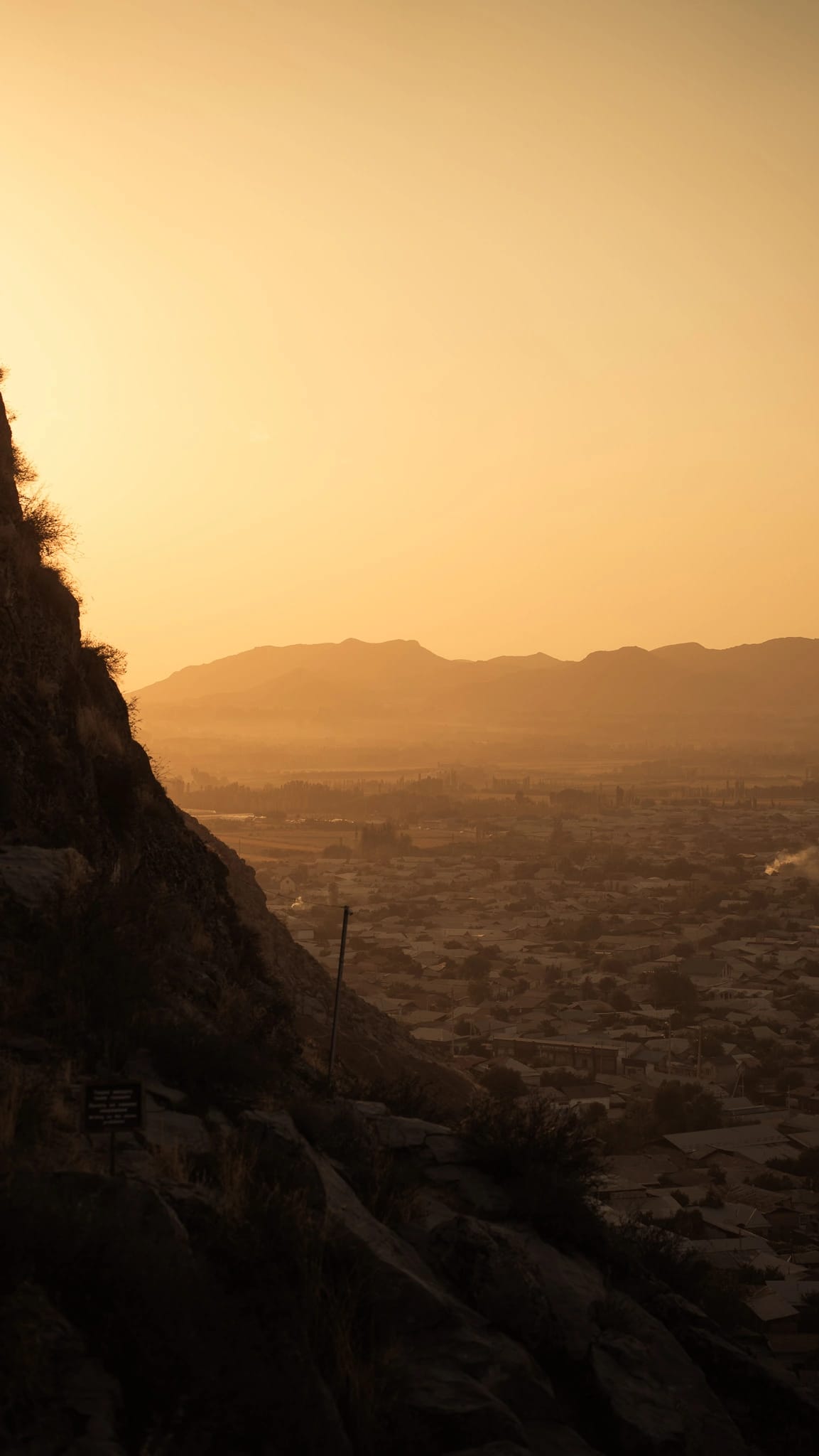
    Day 1 was a same-day return flight, so Osh offered a short visual window rather than a full production day.
    Plan
    Choose one story—city and mountain context—and keep enough margin around both flights. Sulaiman-Too works as the visual anchor.
    Reconfirm
    Check the flight schedule and sunset access before treating an evening frame as feasible.
  2. 2

    Days 2–6

    Let weather and light lead

    Song-Kul · Kel-Suu · Tash Rabat

    Open this phase in the itinerary
    Observed
    Song-Kul brought constant wind, hourly light changes and no mains electricity in our yurt. At Kel-Suu the water changed as wind arrived; Tash Rabat's interior was dark.
    Plan
    Use Days 3 and 5 for patient observation. Prioritise one wide context frame, one human-scale frame and one detail before adding more coverage.
    Reconfirm
    Confirm border-zone access, road and weather conditions, charging options and a daylight arrival with your operator.
  3. 3

    Days 7–8

    Build a transition, not a checklist

    Bokonbaevo · Skazka Canyon · Jeti-Ögüz

    Open this phase in the itinerary
    Observed
    Day 7 was a long transfer and Bokonbaevo a practical base. Day 8 moved from Skazka's sculpted colour to the larger red formations at Jeti-Ögüz.
    Plan
    Keep the transfer day light. On Day 8, photograph colour and shape at Skazka, then use Jeti-Ögüz to widen the sense of scale.
    Reconfirm
    Check opening and access conditions, and ask permission before photographing people or an arranged cultural encounter.
  4. 4

    Days 9–11

    Travel light, then reset

    Karakol · Altyn Arashan

    Open this phase in the itinerary
    Observed
    The UAZ took two to three hours for roughly 30 km. Altyn Arashan had little connectivity; Day 10 was unhurried and Day 11 became a functional Karakol reset.
    Plan
    Carry only what you can protect on the rough approach. Use people, horses or the river to communicate scale, then back up and charge in Karakol.
    Reconfirm
    Confirm the UAZ, road conditions, charging and current connectivity before leaving Karakol.
  5. 5

    Days 12–14

    Close the story with contrast

    Grigoriev Gorge · Cholpon-Ata · Bishkek

    Open this phase in the itinerary
    Observed
    The green gorge and more comfortable north shore felt intentionally quieter after the remote mountain days; Bishkek provided buffer before departure.
    Plan
    Use the softer landscapes and city return as a closing sequence. Back up, select and annotate while the route is still fresh.
    Reconfirm
    Reconfirm current road conditions, transfer time, flight schedule and departure time before using any part of the final-day buffer.

Remote workflow

A four-stage operating rhythm

The route moves between reliable city infrastructure and several days where sockets, signal and cloud backup cannot be assumed.

  1. Before Bishkek departure

    Create an offline baseline

    Download 2GIS, Maps.me and offline translation; clear local storage, charge every battery and ask each remote stay what charging is actually available.

  2. Remote Days 2–6

    Assume local-only capture

    Size power-bank capacity to your devices and remote-day rhythm, then confirm the current airline battery rules. Carry enough cards or local storage: our Song-Kul yurt had no mains electricity, so cloud sync is not the fallback.

  3. Karakol · Days 9 and 11

    Back up, inspect and simplify

    Use the city handoff to make a second local copy, recharge, clean exposed equipment and reduce the kit before the UAZ leg.

  4. At every encounter

    Keep consent ahead of the shot list

    Ask before photographing people or yurt interiors. A respectful conversation is the outcome; an image is optional.

Visible safety boundary

Photography and drones require a separate current check

These notes document my trip; they do not claim current drone permission. National, local, border-zone and operator conditions must be confirmed independently.

  • Carry your passport.
  • Do not photograph or film military sites, police stations or border posts.
  • The same restricted-subject rule applies to drones; access to a place is not flight permission.

Official photography guidance checked · 20 July 2026

Open the sourced Practical Info

Evidence from the route

Five frames, five field decisions

The captions connect each photograph to the choice it demonstrates. They are not presented as camera or exposure metadata.

Osh and the surrounding mountains seen from Sulaiman-Too near sunset

Osh · Day 1

Choose one elevated viewpoint when flight timing leaves only a compact city window.

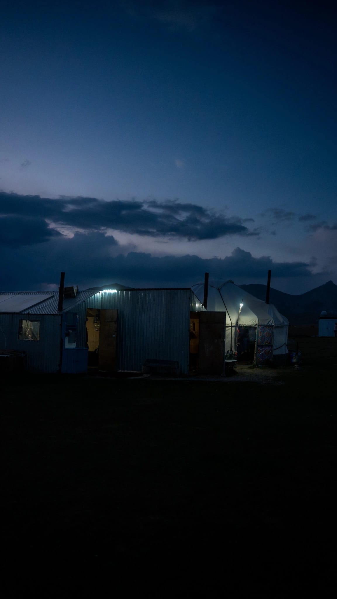
Yurt and simple camp building illuminated at blue hour at Song-Kul

Song-Kul · Days 2–3

Limited power becomes part of the night story; expose for the small pools of practical light.

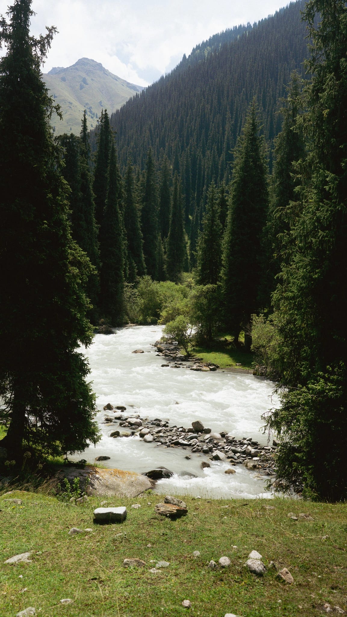
Fast glacial river framed by conifer forest in Altyn Arashan

Altyn Arashan · Day 10

A rest day creates time for quieter vertical frames away from the main valley view.

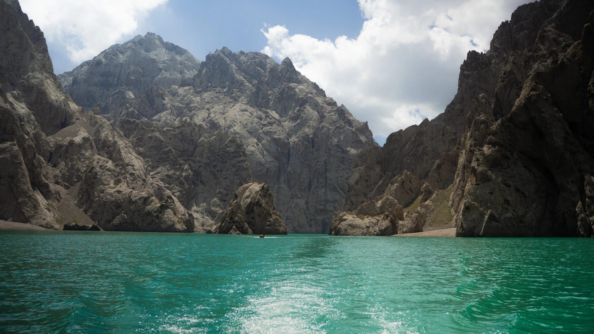
Turquoise Kel-Suu lake enclosed by steep canyon walls

Kel-Suu · Day 5

Wait for the water and wind, then let the small boat reveal the canyon's scale.

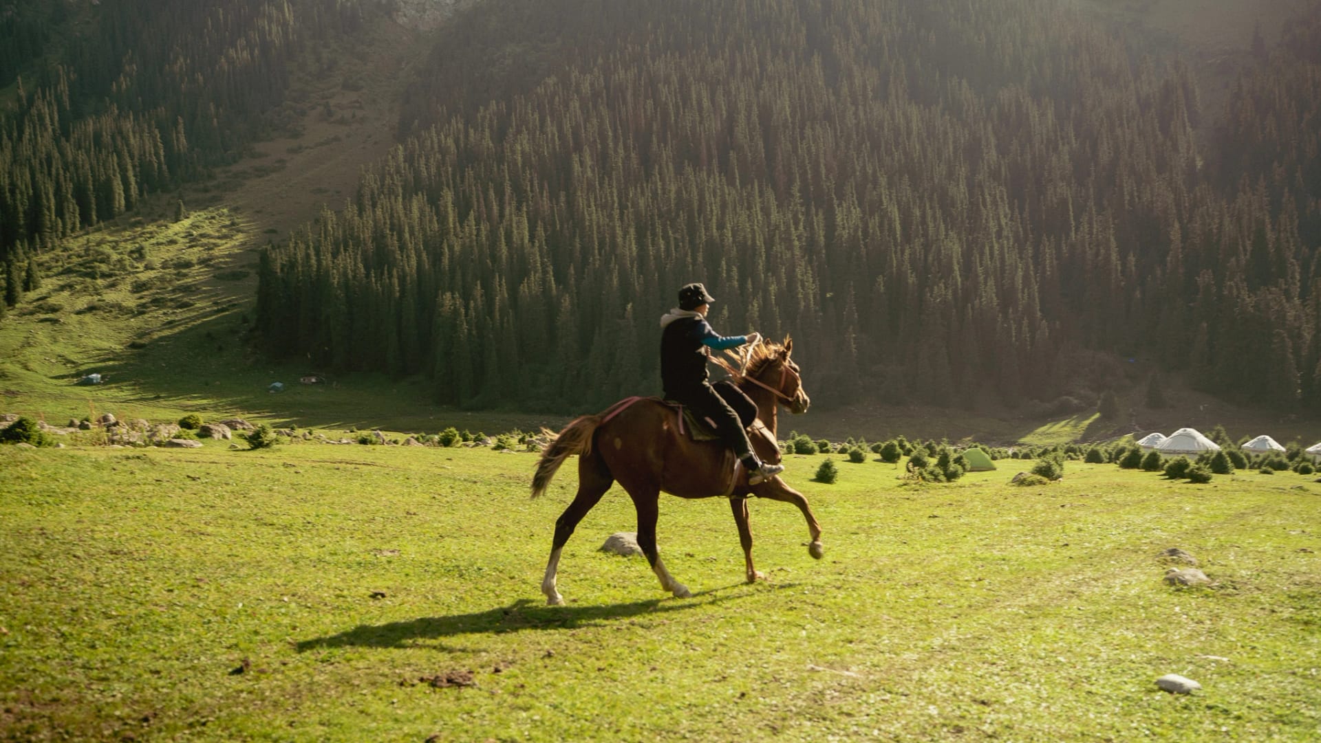
Rider crossing the sunlit Altyn Arashan valley with yurts behind

Altyn Arashan · Days 9–10

Directional light and a moving subject turn a broad valley into a readable sense of scale.

Continue with context

Move from visual intent to an executable plan

Use the planning pages for route truth and current checks, then open the full photography collection for the wider edit.

  • Route Map

    See the full stop order, flight and remote road logic.

    Open Route Map
  • Practical Info

    Verify permits, restricted subjects, safety and offline readiness.

    Open Practical Info
  • Packing List

    Translate the workflow into a route-specific packing check.

    Open Packing List
  • Kyrgyzstan photography

    View the broader visual collection beyond these evidence frames.

    View the photography

Section 7 of 8

PreviousPacking ListNext stepFull Field Notes
TravelKyrgyzstan

Kyrgyzstan

  1. Plan the trip

    Overview
  2. Route Map
  3. Itinerary
  4. Practical Info
  5. Budget & Costs
  6. Packing List
  7. Capture it

    Creator Notes
  8. Read the story

    Full Field Notes

Route Pack waitlist

The free 14-day English planner is available now. The expanded €19 Route Pack is in development.

Get the free English plannerJoin the Route Pack waitlist